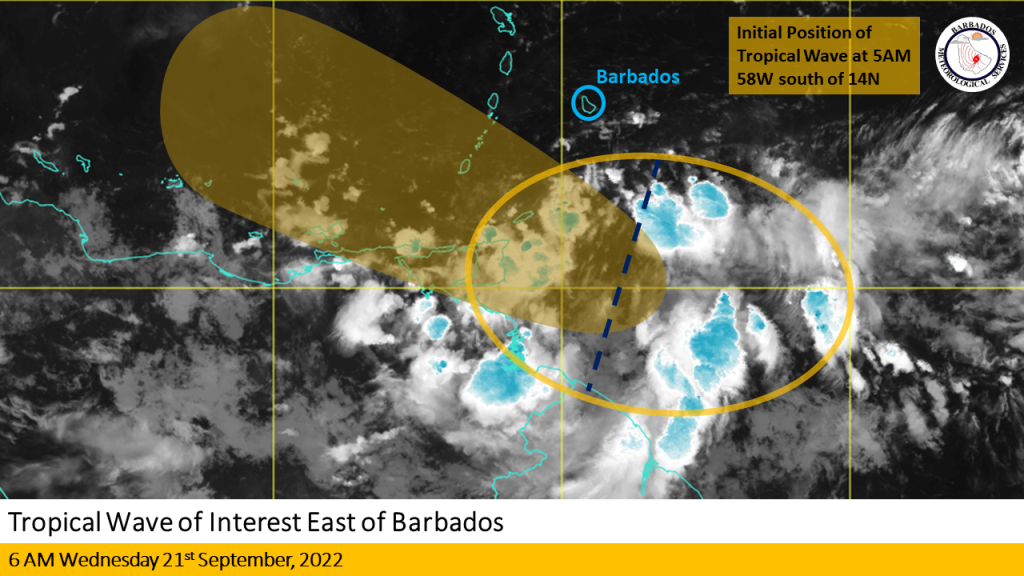
The Barbados Meteorological Services continues to closely monitor the progress of a Tropical Wave located near 58W south of 14N at 5 AM today, Wednesday 21st September 2022.
Current Situation: Over the past 12 hours, satellite imagery continued to show a large area of disorganized convection associated with the tropical wave tracking westward at around 15 to 20 mph (about 25 to 30 km/h).
Intensity and track Forecast: Latest model guidance is in relatively good agreement that most of the activity associated with the system will pass to the south of Barbados this morning. Some slow development of this system is likely and it could become a tropical depression in the Caribbean sea over the next few days.
Rainfall accumulations of up to 1 inch and possibly isolated higher amounts with occasional gusty winds are likely today and tonight as the system passes over the southern Windwards. Residents and visitors are urged to be aware of the possibility of some localized flooding today.
A small-craft advisory remains in effect for above-normal sea swells for Wednesday 21st September 2022.
Recommendations to the public:
-The BMS urges the public to stay alert for weather updates coming from this office.
-Large open water swells can be hazardous to some small vessels.
-Sea bathers are advised to exercise extreme caution, particularly on the eastern and southern beaches today and into tomorrow.
This is the final information statement on this system.


More Stories
Historic win for Bajan golfer
Israeli missile strikes Iran
Guyanese authorities probing sibling’s deaths