This alert from the Barbados Meteorological Services is valid from 6:15 a.m Tuesday, October 11, 2022 and will be terminated at 12 noon today, or sooner if conditions warrant.
Hazard Info:
Rainfall accumulations of 20.0 to 30.0 mm in moderate to heavy showers are likely as a tropical wave in conjunction with favourable mid to upper-level environment affects the island.
A flash-flood watch is issued when heavy or excessive rainfall in a short period of time (generally less than 6 hours) could result in flash flooding within the watch area. It does not mean that flooding will occur, but it is possible.
Key Message: Residents and visitors should note that the following impacts are imminent during this forecast period:-
- Significant runoff from higher elevations.
- Significant soil erosion is likely on exposed or scarred land surfaces.
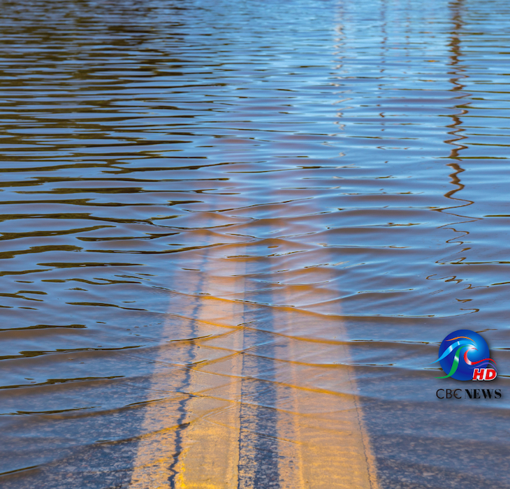
- Large water settlements on roads and fields.
- Significant adjustments to water levels of existing water bodies (ponds etc.).
- Significant delays on traffic routes with some roads possibly impassable.
- Large objects or debris from higher elevations may also become embedded within fast-moving water flows.
- Significant flooding at the foot of hillsides and coastal roads is possible.


More Stories
Solutions in progress
Trump meeting with Netanyahu
Multi-million dollar grant for Haiti