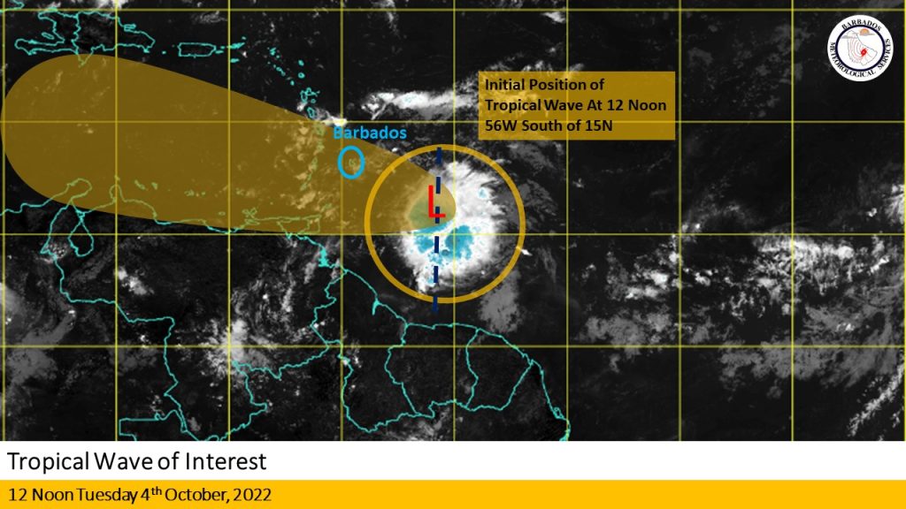
The Barbados Meteorological Services continues to closely monitor the progress of a tropical wave located near 56W south of 15N at 12 noon today, Tuesday, October 4th, 2022.
It says overnight and during the course of the morning, deep convection increased near the centre of the mid-level circulation, located near 11N 56W. This is about 430 km ( 270 miles) east southeast of Barbados.
The system remains disorganized, however deep convective development is expected to continue over the next 12 to 24 hours.
Conditions will be marginally favorable for some slow development throughout today as it approaches Barbados and the Windward islands. Model guidance is now suggesting that the upper-level trough will shift farther north, which should allow for some slow development of the system to continue as it passes across the region in the early hours of Wednesday.
The BMS says the system is expected to track west to west-northwestward at 10 to 15 mph over the next 12 to 24 hours, bringing it into our area in the early hours of tomorrow, Wednesday, October 5th, 2022.
Regardless of development, this wave could produce 2 to 3 inches of rainfall with isolated higher amounts of 4 inches in moderate to heavy showers. Winds are currently predicted to range between 25 to 35 mph with higher gusts of 45 to 55 mph.
The next update will be at 5:00 p.m. today or sooner if conditions warrant.


More Stories
Tributes flow for George Nicholson
64 cars to hit the raceway for Shakedown Stages
Thousands attend Legends in the Garden show