
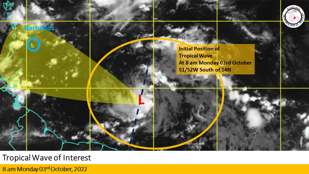
The Barbados Meteorological Services (BMS) is closely monitoring the progress of a tropical wave located near 51/52W south of 14N at 8 am today Monday, October 3, 2022.
Current Situation: Overnight convection associated with the system increased with the development of a low-level circulation evident on BMS satellite imagery near 9N 51W. The system remains disorganized however, some sporadic development of deep convection is expected to continue over the next 12 to 24 hours.
Intensity Forecast: Conditions are currently marginally favorable for slow development over the next 24 to 36 hours as it approaches Barbados and the Windward islands. Model guidance suggests that further development is likely over the next few days.
Track Forecast: The system is expected to track north-westward at 15 to 20 mph over the next 24 to 36 hours with some reduction in forward speed as the system interacts with a deep layered trough which is forecast to be anchored across the region on Wednesday.
Special Note: Regardless of development this wave, in combination with a deep layered trough, it will bring some moderate to heavy showers and occasional gusty winds to Barbados on Wednesday into Thursday.
Recommendations to the public: Stay alert for updates from the BMS on this system over the next 24 to 36 hours.
The next update will be on Monday 3rd October 2022 at 5 pm or sooner if conditions warrant. (BMS)


More Stories
Solutions in progress
Trump meeting with Netanyahu
Multi-million dollar grant for Haiti